Sanborn Maps
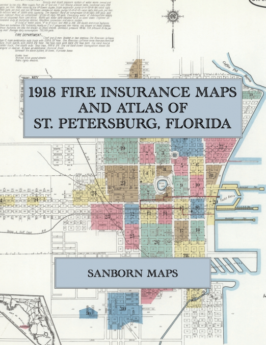
Facsimile of the 1918 Sanborn fire-insurance atlas of St. Petersburg, Florida, reproduced in full color from the Library of Congress copy. It covers the Pinellas County resort city of 12,000 people in summer and 25,000 in winter, from the hotels, stores and banks of Central Avenue and the City Park out along the Atlantic Coast Line and the Tampa and Gulf Coast railroads to Mirror Lake, the Yacht Basin, the Municipal Pier and the bath houses on Tampa Bay, Bayboro and Booker Creek, the streets out to Coffee Pot Bayou, and the golf club at Davista.The twenty-nine numbered sheets that follow the key map work block by block from the stores, banks and offices along Central Avenue and First, Second, Third, Fourth and Fifth Streets - the City Hall and Jail, the Post Office, the Police Station, the Carnegie Public Library, the Armory, the Arcade Building, the Masonic Hall, the Times and Evening Independent printing offices, the La Plaza Theatre, the Y. M. C. A. hall, the Detroit, Huntington, Poinsettia, Ansonia, Albermarle, Allison, Floronton, Central, Northern, Western, Beach, Bay Shore and Sunset hotels, the Hotels Columbia, Manhattan, Phoenix and Randolph, the Edgewater and West Coast inns and the scores of apartment houses and boarding houses of the winter colony - through the Atlantic Coast Line passenger station, freight depots and pier, the Seaboard Air Line and Tampa and Gulf Coast stations, the St. Petersburg and Gulf Railway car barn and novelty works, the Favorite Line freight house, the Southern Express office, the citrus-packing plants of C. B. Potter and others, the Citizens’ Ice and Cold Storage, Polar Ice and Economy Ice plants, the Crescent Tile and Farmers Concrete works, the Avery and Roberts marine works and boat builders, the Bowling, Muller and Squier lumber yards, the Painter fertilizer works, the Standard Oil and Gulf Refining plants, the Municipal Gas Works and the City Water Works and incinerator, to the City Hospital, the Mercy Hospital and the Roser Nurses’ Home, the High School, the Graded Schools, the North Side Ward, Glen Oak, Roser Park and Industrial schools, the Florida Winter Art School, the Florida Masonic Widows’ and Orphans’ Home, St. Peter’s Episcopal, the Roman Catholic, First Avenue Methodist, First Baptist, Congregational, Presbyterian, Christian Science, Universalist, Trinity Lutheran and Seventh Day Adventist churches and the Bethel A. M. E. and Mt. Olive churches, the City Park with its band stand, roque grounds and chess club, the Yacht Club, the Spa Bath House, the Natatorium and the Concert Band Pavilion on the Yacht Basin, the Municipal Pier, the St. Petersburg Golf Club at Davista, and the residential streets of Roser Park, Bayboro, Booker Creek and Coffee Pot Bayou.In July 1918 the Sanborn Map Company of New York surveyed St. Petersburg for the fire-insurance trade, drawing the business district and inner blocks at fifty feet to the inch and the outer residential streets, the waterfront and Davista at one hundred feet to the inch. Every building is shown to scale and color-coded for construction (yellow for frame, pink for brick, blue for stone), with heights, uses, windows, party walls, hydrants, water mains and fire stations all marked. The index lists every street and every named business, church, school, hotel, mill and works with the sheet it appears on, and the key map places the colored sheet grid over the whole city.This Exile Books edition is an unabridged facsimile republication of the atlas: the title and index sheet and all thirty numbered map sheets, 1 to 30, sheet 1 being the key map with its report on the water works and fire department, the others covering the city from the business blocks of Central Avenue and the Atlantic Coast Line yards to Mirror Lake, the Yacht Basin and the piers on Tampa Bay, Bayboro, Coffee Pot Bayou and the golf club at Davista, printed at 8.5 x 11 inches on premium color paper.