Sanborn Maps
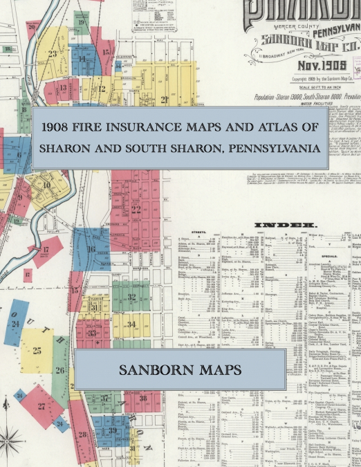
Facsimile of the 1908 Sanborn fire-insurance atlas of Sharon and South Sharon, Pennsylvania, reproduced in full color from the Library of Congress copy. It covers the Mercer County steel town of 13,000 people on the Shenango River at the Ohio line, from the stores, banks, hotels and opera house of State and Main Streets out along the Erie, Pennsylvania and Lake Shore railroads to the rolling mills, furnaces, tin-plate and wire works, the schools, churches and residential streets, and the Borough of South Sharon with the great United States Steel plants and the streets off Broadway.The thirty-eight numbered sheets that follow work block by block from the stores, banks and offices along State Street, Main Street, Water, Chestnut, Dock, Pitt and Silver Streets and Railroad Street - the Post Office, the Fire Department, the Hamory Bank Building, the Bell Telephone Building, the I. O. O. F. Block, the Lewis, Luse and Marshall blocks, the Morgan Grand Opera House, Carver Hall, the Buhl Armory and Buhl Club, the Daily Telegraph printing office, the Sharon College of Commerce, the Morgan, Colonial, Commercial, Central, Exchange, Arlington, Globe, Peer, Pittsburg, Thomas, Windsor and European National hotels, the Shenango House and Rankin House - through the Erie, Pennsylvania, Erie and Pittsburgh and Lake Shore and Michigan Southern depots, freight houses and locomotive houses, the Valley Street Railway depot, the Carnegie Steel works, the American Sheet and Tin Plate Company’s Sharon and Mercer works, the American Steel and Wire Company’s works and foundries, the United States Steel plants of South Sharon, the Sharon Steel Hoop Company, the Stewart Iron Company rolling mill, blast furnace and cement works, the Shenango Iron and Steel and Shenango Machine companies, the Republic Iron and Steel Company’s Hall Furnace, the National Malleable Castings works, the Driggs Seabury Ordnance gun and automobile frame factory, the Wilkes Rolling Mill, the Sharon Boiler, Foundry, Fire Brick, Hardware and Pattern works, the Damascus Brake Beam and American Sewer Pipe companies, the Freedom Oil Works, the Union Brewing Company, the Shenango Valley flour mill, the Youngstown Consolidated gas and electric plant, the Sharon Water Works pumping station and the lumber yards and planing mills, to the Buhl Hospital, the High Schools of Sharon and South Sharon, the Hall Institute and the ward schools, Sacred Heart, St. Ann, St. Elizabeth’s, St. Joseph’s and Italian Catholic churches, St. Michael’s Russian Greek Catholic Church, the Slovak churches, the Baptist, Methodist, Presbyterian, Congregational, Lutheran, Reformed and A. M. E. Zion churches, the Synagogue, and the residential streets of Sharon and South Sharon.In November 1908 the Sanborn Map Company of New York surveyed Sharon and the Borough of South Sharon for the fire-insurance trade, drawing them at fifty feet to the inch. Every building is shown to scale and color-coded for construction (yellow for frame, pink for brick, blue for stone), with heights, uses, windows, party walls, hydrants, water mains and fire stations all marked. The index lists every street and every named business, church, school, hotel, mill and works with the sheet it appears on, and the key map places the colored sheet grid over the whole city.This Exile Books edition is an unabridged facsimile republication of the atlas: all thirty-nine numbered map sheets, 1 to 39, sheet 1 being the combined title, key map and index sheet with its report on the water works and fire departments, the others covering Sharon from the business district on the Shenango River to the mills and furnaces, and the Borough of South Sharon with its steel plants, printed at 8.5 x 11 inches on premium color paper. Ideal for local historians, genealogists, architects, preservationists and anyone tracing a Sharon address back to 1908.